
Rivers
The core of historical India emerged from its vital rivers, which flourished under the tropical monsoon rains. These include the plains of the Indus system, the Indo-Gangetic divide, the Ganges basin and the Brahmaputra basin. From west to east we find that the annual rainfall increases by 25 to 250 cm. The vegetation of the Indus, based on a rainfall of 25 to 37 cm, and possibly the vegetation of the Western Ganga, based on a rainfall of 37 to 60 cm, can be cleared with stone and copper tools and become cultivable. But this was not possible in the case of the vegetation in the middle of the Ganga based on 60 to 125 cm rainfall and certainly not possible in the case of the vegetation in the lower Ganga and Brahmaputra based on 125 to 250 cm rainfall. In densely forested areas, where the soil was hard, clearing could be done only with the help of iron tools, which became available later. Therefore, the natural resources of the low-rainfall western region were used first and large-scale human settlements generally spread from west to east.
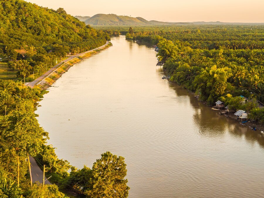
Once agriculturalized, the Indo-Gangetic plains produced abundant crops and increasingly supported cultures. The flat plains of the Indus and western Ganges produced mainly wheat and barley, while the middle and lower Gangetic plains produced rice on a large scale, which was the main source of food in Gujarat and south of the Vindhyas. Harappan culture originated and developed in the Indus Valley Hui; Vedic culture originated in the North-West Frontier Province and Punjab and flourished in the western Ganga basin; The post-Vedic culture, based primarily on the use of iron, prevailed in the middle Ganges basin. The lower Ganga valley and northern Bengal actually received attention in the Gupta period and finally the importance of the Brahmaputra valley including Assam increased in the pre-medieval period. Powerful rulers fought for possession of these plains and valleys and the Ganga-Yamuna Doab in particular proved to be the most coveted and contested area. Rivers served as arteries of commerce and communication. In ancient times, construction of roads was difficult, so communication between people and goods was done by boat. Therefore, river routes proved to be a boon for military and commercial transportation. Apparently the stone pillars built by Ashoka were transported by boat to different parts of the country. The importance of rivers for communication continued till the East India Company period. In addition, rivers filled neighboring areas with water and made them fertile; They also supplied water to the canals from the rivers. However, these rivers also brought floods, which from time to time destroyed cities and villages in the northern plains and hence many ancient buildings were completely washed away and destroyed. Nevertheless, important cities and capitals like Hastinapura, Prayag, Varanasi and Pataliputra were located on the banks of rivers. In modern times, urban areas are located at road and railway junctions or in industrial or mining areas, but in pre-industrial times most cities were located on river banks and junctions.
Overall, it was rivers that delineated political and cultural boundaries, which were also formed by mountains. Thus, in the eastern part of the Indian peninsula, the region known as Kalinga lay between the Mahanadi in the north and the Godavari in the south, through the coastal region of Orissa. Similarly, Andhra Pradesh lies mainly between the Godavari in the north and the Krishna in the south. The deltaic plains formed at the mouths of these two rivers increased in importance with the rise of towns and ports during the reign of the Satavahanas and their successors at the beginning of the Christian era. Ultimately the major part of Tamil Nadu was situated between Krishna in the north and Kaveri in the south. The Kaveri valley extended almost up to the Vaigai River in the south and up to the South Pennar River in the north. It formed a distinct geographical area and became the center of Chola power shortly before the beginning of the Christian era. This region was distinct from northern Tamil Nadu, which included the upper regions, and became prominent under the Pallavas by the 4th–6th century. The eastern part of the peninsula is bounded by the Coromandel Coast. Although the coast is surrounded by the Eastern Ghats or stairs, these Ghats are not very high and due to the easterly flow many mouths open into the Bay of Bengal.